I. Scientific Research Value
The fold/thrust structures and ductile shear zones of the Neoarchean orogenic belt of the North China Craton (Zanhuang Terrane), together with many geological relics such as the typical clastic rock landform unique to the Taihang Mountains—the Zhangshiyan landform—are rare, representative, and complete. They provide many comparative research topics of global significance for geoscientists at home and abroad.
(1) Scientific Value of Neoarchean TTG Research in the North China Craton
The North China Craton is one of the oldest cratons in the world. Its crystalline basement is mainly composed of Archean supracrustal rocks, TTG rocks, and potassium-rich granites. The oldest rocks can be traced back to 3.8 Ga and record multiple phases of tectono-magmatic activity from 3.8 to 2.5 Ga. Therefore, the North China Craton is an ideal area for studying the formation and evolution of early continental crust. Neoarchean granites show typical dome-and-keel structural patterns, Neoarchean metamorphism displays counterclockwise P-T-t paths, and large quantities of 2.5 Ga TTG rocks formed rapidly in the North China Craton. These features indicate that the Archean evolution of the North China Craton was mainly controlled by a mantle plume tectonic regime. Its unique geological structures and petrological characteristics provide empirical support for the uniformitarian hypothesis of Precambrian global tectonic regimes, proving that early Earth orogenic events had a scale, evolution, and duration similar to those of modern plate tectonic systems. The abundant geological relics in the park provide valuable scientific evidence for understanding early Earth tectonic evolution and geodynamic processes, and are of great significance for the continuous development and improvement of global geology and plate tectonic theory.
(2) Scientific Evidence of Ductile Shear Zones and Plate Subduction in Paleoproterozoic Metamorphic Complexes
A sinistral thrust-type ductile shear zone is developed in the low- to medium-grade metamorphic rocks of the Early Precambrian Paleoproterozoic Gantaohe Group metamorphic complex within the park. The area shows intense tectonic deformation, mainly characterized by folds and ductile shear zones. Within the ductile shear zone, macro- and microstructures such as mylonites, stretching lineations and crenulation lineations, asymmetric folds, boudinage structures and tectonic lenses, S-C fabrics, and rotated porphyroclasts are developed. The consistent macro- and microscopic deformation features, including S-C fabrics, rotated porphyroclasts, and asymmetric folds, indicate that the hanging wall of the ductile shear zone moved from west to east in a thrusting manner. The identified subduction-related rock assemblages, together with the fold/thrust structures and ductile shear zones of the Neoarchean orogenic belt (Zanhuang Terrane), represent one of the oldest suture zones and show that the Neoarchean tectonic evolution of the North China Craton was mainly related to subduction under a plate tectonic regime. The definition of this ductile shear zone provides important scientific evidence for the Paleoproterozoic tectonic evolution of the southern Taihang Mountains.
(3) Scientific Value of the Unconformity Surface of the Lüliang Movement
The unconformity surface of the Lüliang Movement records the transition between land and sea in the North China Block and serves as a concrete example of continental-oceanic transformation in the global tectonic system. This unconformity is exposed in many places in the western part of the park. It shows an obvious angular unconformity between the Paleoproterozoic metamorphic rocks of the Gantaohe Group and the overlying Mesoproterozoic sandstones of the Changcheng System, representing the contact relationship between the craton basement and its cover. Influenced by the Lüliang Movement, the Gantaohe Group underwent metamorphism, deformation, erosion, and planation. A basal conglomerate of the Lüliang surface was formed at the top of the Gantaohe Group, serving as a representative horizon of the Lüliang Movement surface. This unconformity is an important tectonic episode marking the boundary between the Paleoproterozoic and Mesoproterozoic, and provides key evidence for the transition from a terrestrial environment to a marine environment. This geological relic is an important marker of tectonic evolution and sedimentary environmental change, recording crustal tectonic movement and evolution. It was the Lüliang Movement that formed the stable North China Plate. The Lüliang Movement coincided with the final formation of the Columbia supercontinent and has geological responses in Tarim of China, Africa, Australia, Siberia, North America, Eastern Europe, and other regions. It can be internationally compared with major tectonic events such as the Hudsonian Orogeny in North America and the Karelian Orogeny in Europe.
(4) Scientific Value of Zhangshiyan Geomorphological Research
The formation of the Zhangshiyan landform is closely related to crustal movement and tectonic activity. Studying its geological structure helps us understand regional crustal evolution. The rock composition of Zhangshiyan marks the beginning of the stable North China Platform, and its stratigraphic sequence is complete and typical. Through the study of Zhangshiyan’s geological structures and stratigraphic lithology, the history of tectonic movement and changes in sedimentary environments can be inferred.
The Zhangshiyan landform is one of China’s three major sandstone landforms, clearly displaying the four stages of landform development: infancy, youth, maturity, and old age. Developed in Mesoproterozoic strata, it was mainly formed by tectonic uplift and gravitational collapse. It is a clastic rock landform represented by giant long cliffs, stepped cliff ledges, box-shaped zhang valleys, amphitheater-like valleys, canyons, mesa mountains, rows of peaks, and peak pillars. Zhangshiyan is a classic example of the coordinated development of endogenic and exogenic geological processes, and its unique landform provides a scientific site for studying exogenic geological processes such as erosion and weathering.
Together with the Danxia landform and Zhangjiajie landform, the Zhangshiyan landform is known as one of China’s three major sandstone landforms. In 2009, it was shortlisted for the “Major Discoveries of Chinese Geography in the Past Century,” and Zhangshiyan Scenic Area is the discovery site and naming place of this landform. This geological relic records the geomorphic evolution of the Taihang Mountains and even the entire North China region since the Paleogene, as well as the strong uplift of the mountains since the Quaternary. The spatial combination of various landform bodies reveals the unique development model of the Zhangshiyan landform—wedge-shaped lateral cutting and horizontal undercutting—innovating and enriching modern geomorphic development theory. The Mesoproterozoic Changcheng System sandstones contain complete, typical, and well-preserved bedding and bedding-plane structures, which are rare in the world and have extremely high research value. They clearly display different stages of landform development—infancy, youth, maturity, and old age—making the area an ideal place for studying and investigating the relationship between geological structures and geomorphic landscapes.
II. Science Popularization and Study Value
(1) Local Science Popularization Activities
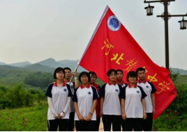
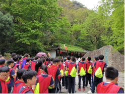
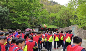
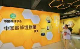
Local science popularization education activities mainly target young students. Primary and secondary school students are organized to visit geological science corridors or geological culture roads, where they are introduced to science knowledge about the park’s natural geography, geological science, forest vegetation, and cultural treasures, so as to promote quality education among young people. Spring and autumn outings for primary and secondary school students are arranged in the park when appropriate to stimulate their curiosity about geoscience knowledge. Scientific experiments, competitions, and other science practice activities are organized to popularize basic geoscience knowledge. Experts are invited to give science lectures and explain geological phenomena in a scientific way. Activities such as “knowledge quizzes, landscape-themed essays, and photography competitions” for primary and secondary school students are also held to inspire young people to explore the mysteries of the Earth, cultivate their love for the great rivers and mountains of the motherland, improve their ability to observe their hometown, and stimulate their interest and affection for their homeland, thereby enhancing their humanistic qualities of loving their family, hometown, and country.
| 
|
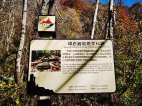
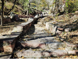
Zhangshiyan Geological Culture Road |
| 
|
| 
|
Science Popularization and Study Activities for Primary and Secondary School Students |
(2) Teaching Practice Activities
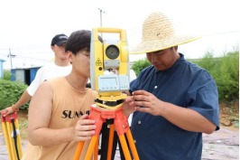
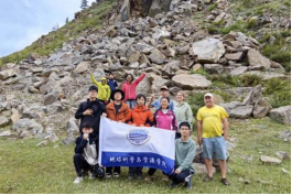
Teaching practice activities are mainly carried out for teachers and students from universities, colleges, and vocational institutions. Teachers and students from different majors are encouraged to come to the park for internships, scientific research, and degree thesis writing. The park focuses on organizing field practice and investigations along major geological tourism routes, covering mountain landforms, metamorphic rock sections, and plate suture zones. It also supports scientific research on plant classification, ecological environment surveys, and plant communities, so that the geopark can truly become a base for scientific exploration by teachers and students and a cradle for the growth of scientists. Plans are also made to establish teaching practice and scientific research bases. For universities, colleges, vocational institutions, and scientific research institutes, research and internship bases will be set up to provide platforms for scientific research and teaching practice across various disciplines.
|
Scientific Research and Teaching for Universities, Colleges, and Vocational Institutions |
(3) Science Popularization Activities for the Public
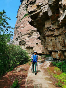
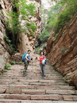
Visitors are guided into the geopark through geological tourism, mountain hiking, ecological investigations, and other activities, allowing them to gain a comprehensive understanding of the geological landscapes, natural scenery, and cultural landscapes of Taihang Mountain Zhangshiyan Geopark. Profound geological science knowledge is presented to the public in an accessible and easy-to-understand way. The training of geoscience guides is strengthened to cultivate a high-quality geoscience guide team, integrating science popularization knowledge into tour guide interpretation and introducing it to visitors through guide explanations. The park also uses various media to communicate scientific knowledge and highlight the purpose of geopark science popularization. In addition, the park strengthens the development of its management team. Through on-the-job education, entrusted training, and other forms, the scientific literacy of cadres and staff is improved. The park also plans to introduce highly educated professionals with relevant backgrounds to join the front line of science popularization and research work, thereby strengthening its own science popularization and research team.
|
Visitors Hiking in the Geopark
| 
|
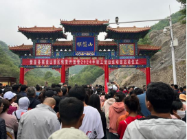
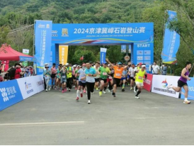
Park Hiking Festival |

|
News Media Broadcasting at the Park Visitor Center |